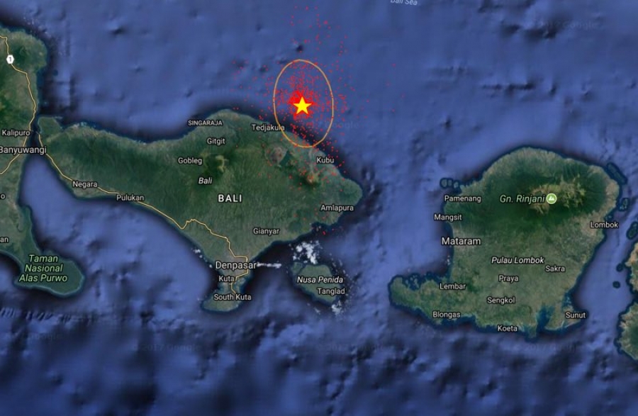
16/02/2018, at 10.37 AM. The Klunkung area has been schaked with 4.4 magniture earthquake ,
The epicenter was located in rhe indian ocean at dept of 66 km with coordinates 9.14 LS-115.42 BT
According to the Head of Center III MKG Region Denpasar, Drs. Taufik Gunawan, Dipl SEIS,
the impact of the earthquake felt the southern region of Bali, at Denpasar, Kuta, and Nusa Dua.
This earthquake shock, he added, was reportedly felt by few people in the region.
He affirmed that the impact of the earthquake on the I-II intensity scale of SIG-BMKG
has not been potentially damaging and so far there has been no reported damage.
Described this earthquake occurs Indoz-Australian Plate subduction activity that dipaks under the Eurasian Plate.
This earthquake is included in the classification of the intermediate earthquake in the Benioff Zone
, the tectonic plate lane that has begun to dip.
The BMKG modeling results show that this earthquake is not a potential tsunami
. "Residents on the southern coast of Bali are urged to remain calm and unaffected by issues that can not be justified
," he said.Meanwhile, although the source of the earthquake is in Klungkung,
there was no panic and is not be considered as volcano earthquake